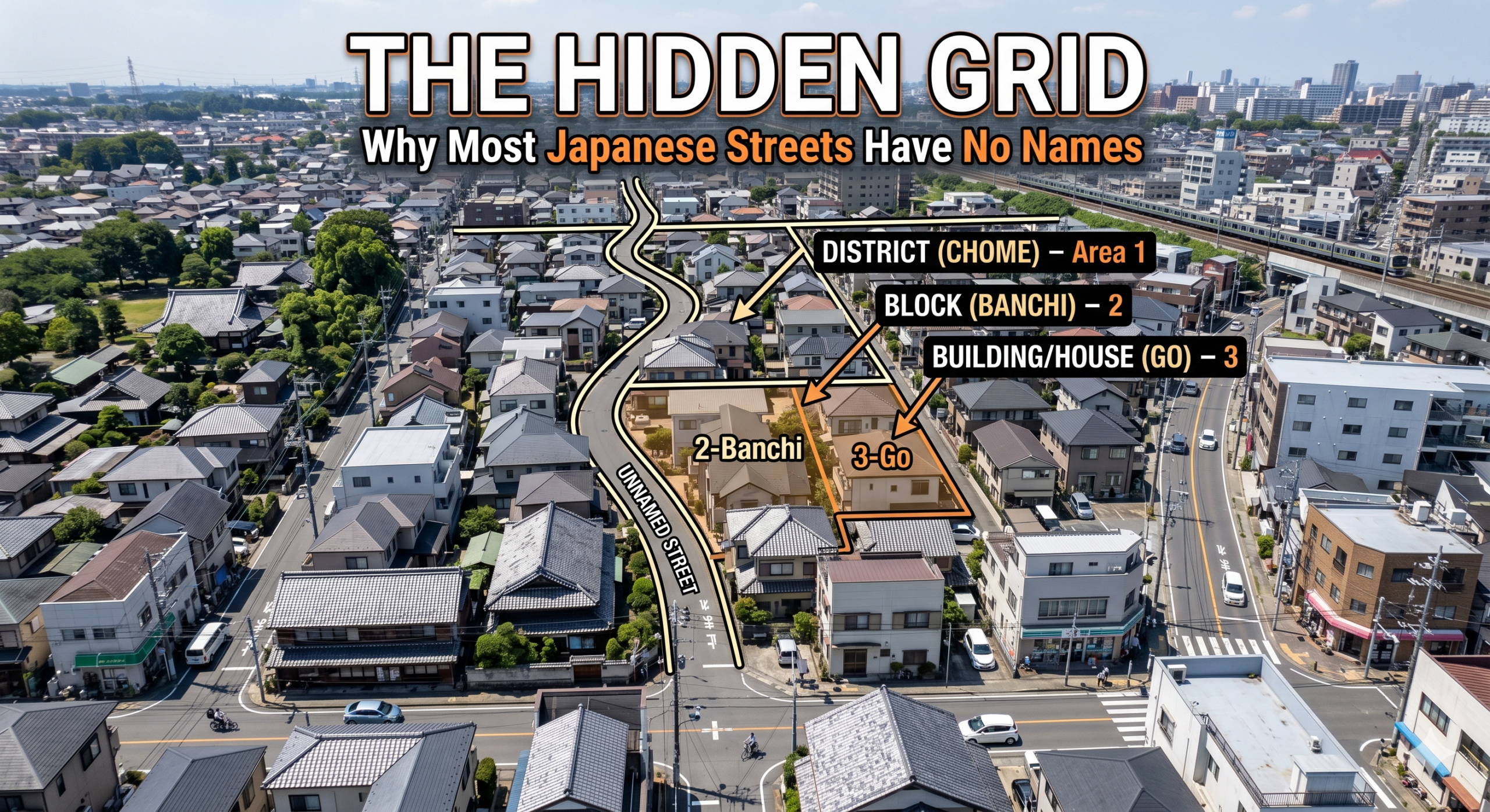
If you are a traveler from North America, Europe, or almost anywhere else in the western hemisphere, your first attempt at finding a specific location in Japan will likely be a deeply confusing experience. You might step out of a train station, pull up your destination on a map, and look around for a street sign that says “Main Street,” “Oak Avenue,” or “1st Boulevard.” You will quickly realize something astonishing: those signs do not exist. Aside from a few major arterial highways, the vast majority of streets, roads, and alleyways in Japan simply have no names.
To a western mind, a city without street names sounds like a recipe for absolute chaos. How does the mail arrive? How do emergency services find you? How do you tell a friend where to meet for coffee? The answer lies in a completely different geographical philosophy. Western cities are organized around lines (the streets), while Japanese cities are organized around spaces (the blocks).
Today, we are going to decode this hidden grid and explore why the Japanese address system is one of the most fascinating infrastructure quirks in the world.
The Western “Line” vs. The Japanese “Space”
In a western address system, the street is the primary anchor of location. A building is defined by its relationship to the road it sits on. If your address is 123 Elm Street, you simply find Elm Street, travel down it, and look for the chronological number 123. It is a linear, predictable journey.
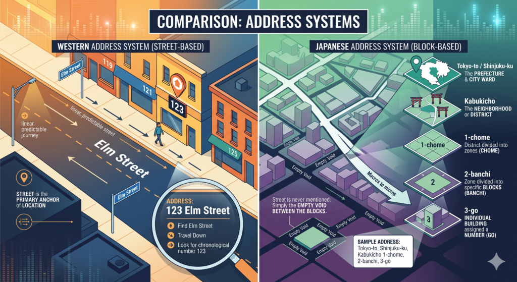
The Japanese system, however, zooms in from the macro to the micro, focusing entirely on designated areas of land rather than the asphalt dividing them. A typical Japanese address looks something like this: Tokyo-to, Shinjuku-ku, Kabukicho 1-chome, 2-banchi, 3-go.
Let us break that down:
- Tokyo-to / Shinjuku-ku: The prefecture and the city ward. (The macro level).
- Kabukicho: The specific neighborhood or district.
- 1-chome: The district is divided into smaller numbered zones, called chome (pronounced cho-meh).
- 2-banchi: Within that chome, the land is divided into specific blocks, called banchi.
- 3-go: Finally, within that specific block, the individual building or house is assigned a number, called go.
Notice that the street you walked on to get there is never mentioned. The street is simply the empty void that happens to exist between the blocks.
The Challenge of the Winding Grid: A Local Perspective
Understanding this system on paper is one thing, but navigating it in reality is a completely different challenge. My own daily routine involves constantly decoding these hidden grids. As a visiting massage therapist, my job requires me to travel directly to clients’ homes spread across Saitama Prefecture. I cannot simply rely on a prominent street sign to guide me to a front door. When navigating the neighborhoods of Kawagoe—a city where beautifully preserved historic Edo-period architecture blends seamlessly into modern, winding residential sprawl—finding a specific house means understanding the logic of the block.
When I am driving or walking through a residential area, missing the correct banchi (block) means I might end up circling a confusing labyrinth of narrow, unnamed alleys. It requires a mental shift: you are not looking for the road you are supposed to be on; you are looking for the invisible boundary of the land you are trying to reach.
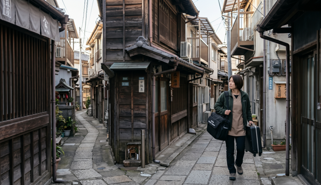
To make matters even more complicated, the final house numbers (go) are not always assigned geographically. Historically, they were often assigned chronologically based on when the house was built. This means that house number 3 might be sitting right next to house number 12, simply because house number 12 was constructed a decade later. While modern urban planning has tried to standardize this into geographical order in newer developments, older neighborhoods remain a chronological puzzle.
Castle Towns and Deliberate Confusion
Why did Japan develop such a seemingly complicated system? To find the answer, we have to look back to the Edo period (1603–1867), a time when Japan was ruled by the Tokugawa shogunate and the country was divided into various feudal domains.
Many major Japanese cities, including Tokyo (formerly Edo) and Kawagoe, originally developed as jokamachi, or castle towns. During this era, urban planning was not about convenience or efficient postal delivery; it was strictly about military defense. The streets surrounding a lord’s castle were intentionally designed to be confusing, narrow, and winding. T-junctions, dead ends, and dog-leg corners were constructed deliberately to disorient invading samurai armies and prevent them from marching in a straight line toward the center of power.
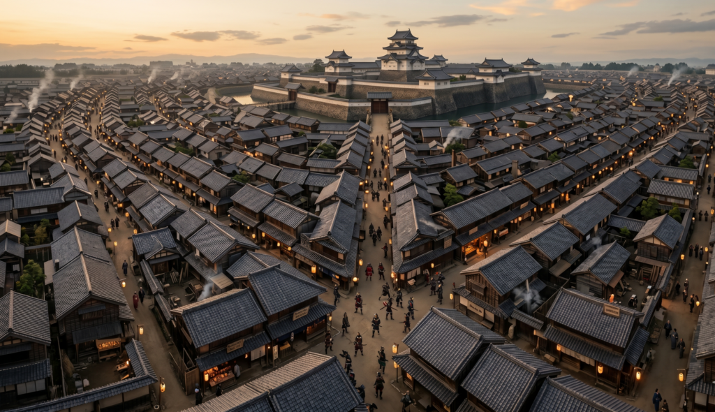
Because the streets were effectively designed as defensive moats, they were not given names. Instead, locations were referred to by the guild or caste of the people who lived in that block—for example, the “blacksmiths’ area” or the “lower samurai district.” When Japan rapidly modernized during the Meiji Restoration in the late 19th century and established a national postal system, the government simply adapted this existing block-based mental map into the modern chome-banchi-go system. The defensive logic of the samurai era became the permanent foundation of modern Japanese infrastructure.
The Rare Exceptions: Kyoto and Sapporo
As with any rule, there are exceptions. If you travel to Kyoto, you will find a city that operates quite differently. Kyoto served as the imperial capital for over a thousand years. It was originally designed in the 8th century, heavily influenced by the ancient Chinese capital of Chang’an. Because it was planned as a grand, ceremonial capital rather than a defensive fortress, Kyoto features a rigid, grid-like layout, and its streets actually do have names. Locals in Kyoto often use a unique directional song to remember the intersecting street names.
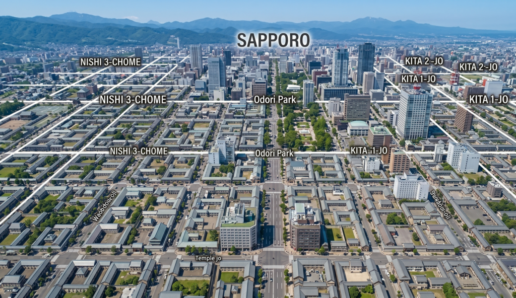
Similarly, Sapporo, the largest city on the northern island of Hokkaido, was primarily developed in the late 19th century with the assistance of foreign advisors from the United States. Consequently, central Sapporo features a very western-style grid system with numbered streets and avenues. But these cities are the outliers. In the vast majority of Japan, the unnamed block reigns supreme.
How Locals Actually Navigate
If there are no street names, how do Japanese people actually give directions to one another?
We rely heavily on landmarks. If I am trying to explain the location of a local retail shop or a client’s home, I will never say, “Take a right on 4th street.” Instead, directions sound like a treasure map: “Walk straight until you see the 7-Eleven, turn left at the corner with the blue vending machine, go past the post office, and it is the third house on the right after the small shrine.”
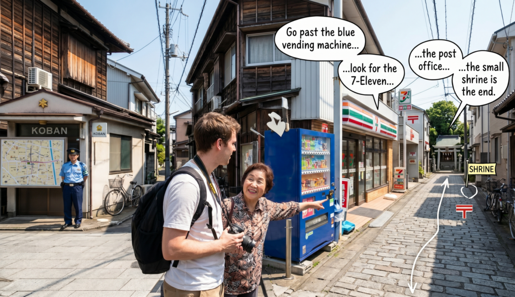
When all else fails, every neighborhood has a Koban, a small local police box. These police officers are the true masters of the local grid. One of their primary duties, besides maintaining safety, is helping lost delivery drivers, tourists, and locals find specific addresses using highly detailed, wall-sized maps of the neighborhood’s blocks.
The Philosophy of Space
Ultimately, the Japanese address system reveals a deep cultural philosophy about how we view our environment. A street-based system prioritizes movement, transit, and the journey from point A to point B. It is an infrastructure built for travelers.
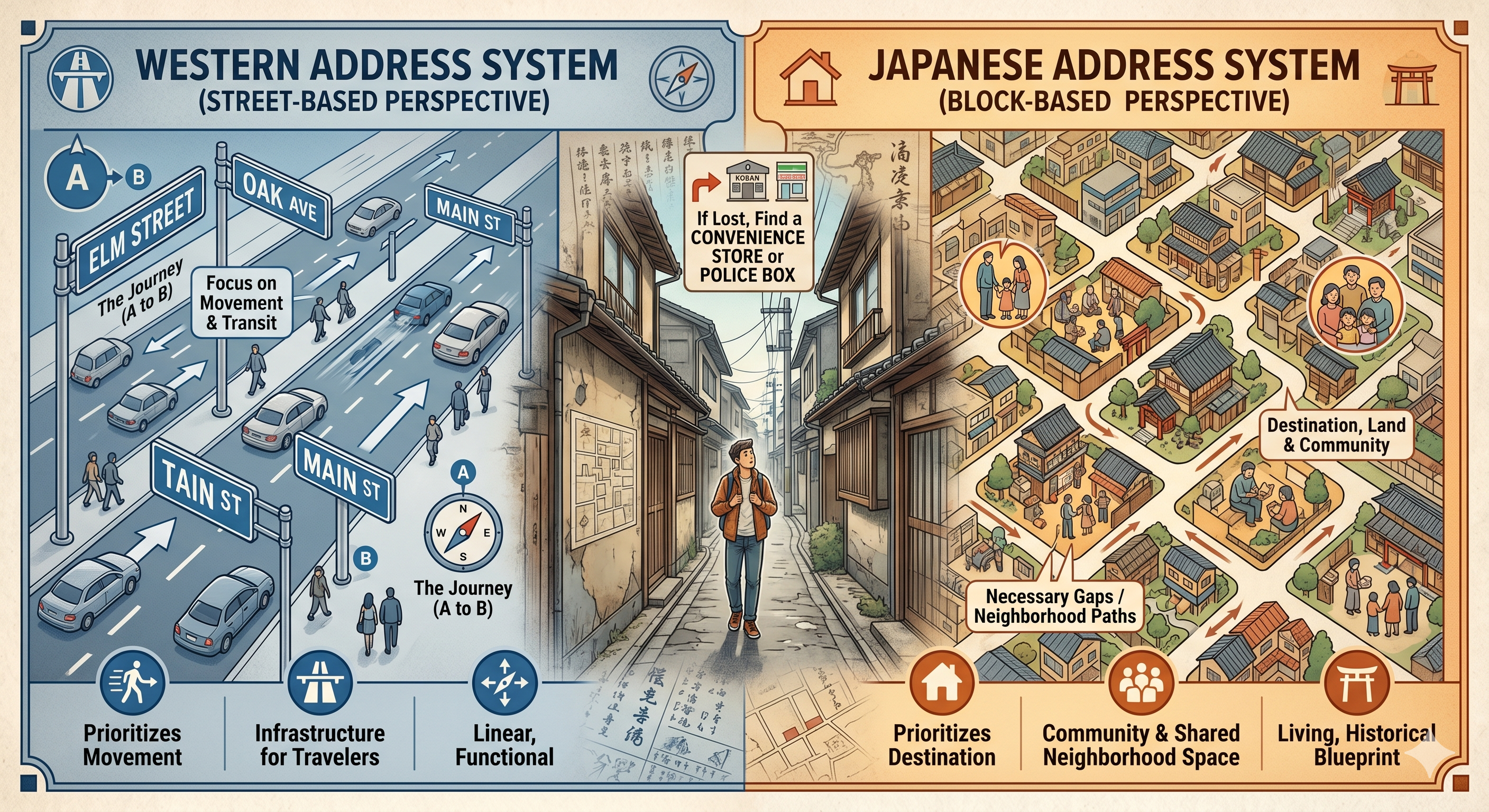
The Japanese block-based system, however, prioritizes the destination itself. It focuses on the land, the community that occupies it, and the shared space of a neighborhood. The roads are simply the necessary gaps that allow us to reach those communities.
The next time you find yourself wandering down a narrow, nameless alley in Japan, do not think of yourself as being lost on an unmarked road. Think of yourself as navigating the spaces between the blocks, walking through a living, breathing blueprint shaped by centuries of history. And if you truly cannot find your way, just look for the nearest convenience store or police box—they will always point you in the right direction.